Seattle is known as a city of neighborhoods – in fact, more than 100 of them. Listed below are free maps, itineraries, and other resources for enjoying self-guided walking tours around the city. The information includes a variety of downloadable maps, online tools, smartphone apps, and printable walking tours and itineraries to plan your urban adventure, whether it’s your first trip or you live in The Emerald City.
Love our cheap ideas? Get our FREE email newsletters. Choose from daily, weekly, and monthly lists. Click here to subscribe.
Seattle walking tour maps
Seattle Walking Tour Map from the City of Seattle let’s you choose a walking route that suits your interests and fitness level. The routes identified in the map come from a variety of sources including Feet First, King County, and the City of Seattle Department of Transportation and include routes that follow sidewalks, shoulders on quiet streets, and park trails.
Seattle Historic Districts: find maps, history, FAQs and other information for the Seattle’s eight historic neighborhoods: Ballard Avenue (north of the ship canal), Columbia City (southeast Seattle), Fort Lawton (within Discovery Park on Magnolia Bluff), Harvard-Belmont (Capitol Hill in central Seattle), International District (aka “Chinatown”, south of downtown), Pike Place Market (downtown Seattle), Pioneer Square (downtown Seattle), and Sand Point Naval Air Station (northeast Seattle).
Seattle trail maps
Seattle Walking Trails and Maps from Rails-to-Trails Conservancy lists top rated routes in Seattle, whether you’re looking for an easy short walk or long trails for an all day outing. In addition, search TrailLink.com to find walks, running trails and bike trails in cities and states across the country.
MapMyWalk/Seattle and MapMyWalk/Washington State from MapMyWalk, a mobile app for iOS and Android, provides popular walking tours along routes and trails in cities and locations across the globe. Download the app and search for a route in your location.
You might also like the following Seattle trail maps:
Seattle Tree Walks
50 Seattle Neighborhood Tree Walks features a list of downloadable maps for every corner of the city. Each map is also featured on the TreeWalk app.
Online Google map of trees at Green Lake in Seattle helps you identify the significant trees along the walking path around the lake. For each tree, there is a popup detailing the tree’s size, habitat, and location, along with a photo of the tree in the landscape and closeups of leaf and flower forms. Your walk can start at any of several starting points: on the path in front of the Green Lake Community Center, the Wading Pool area, the Bathouse, the Aurora strip, Aqua Center, or the southeast shoreline. Green Lake is one of Seattle’s most beloved parks. The 2.8-mile paved path around the lake provides a perfect recreational spot for runners, bikers, skaters, and walkers. Many others use the athletic fields or visit the park for boating, picnics, and swimming.
But wait, there’s more!
- Join free guided hikes with the Issaquah Alps Trails Club.
- For something different, try Walking labyrinths in Washington State.
- Here’s a list of 101+ always free things to do for fun.
- Find free and cheap things to do every day on the Greater Seattle on the Cheap event calendar.
- Visit the Greater Seattle on the Cheap home page and choose from a menu of free and cheap activities in the Puget Sound region.
Love our cheap ideas? Get our FREE email newsletters. Choose from daily, weekly, and monthly lists. Click here to subscribe.
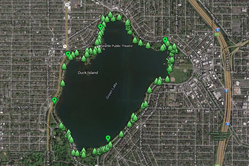
Use this Green Lake trees map for a delightful walking tour of this beloved Seattle park
Visitors and residents alike will find something useful in these Seattle walking tours, maps, and itineraries. Walking is a great way to explore the city whether it’s your first visit, you recently moved here, or have lived in Seattle your entire life. There’s a lot to see, so get walking around Seattle today.

